
“The question isn’t whether small models are perfect. It’s whether they’re useful enough to build with.” […]
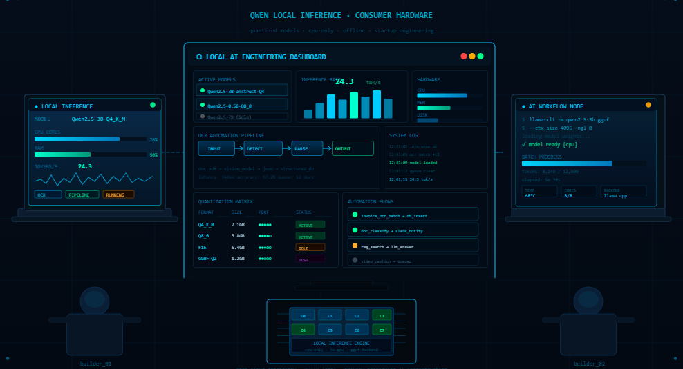
“You don’t need a data center to run useful AI anymore. That changes everything.” I remember […]
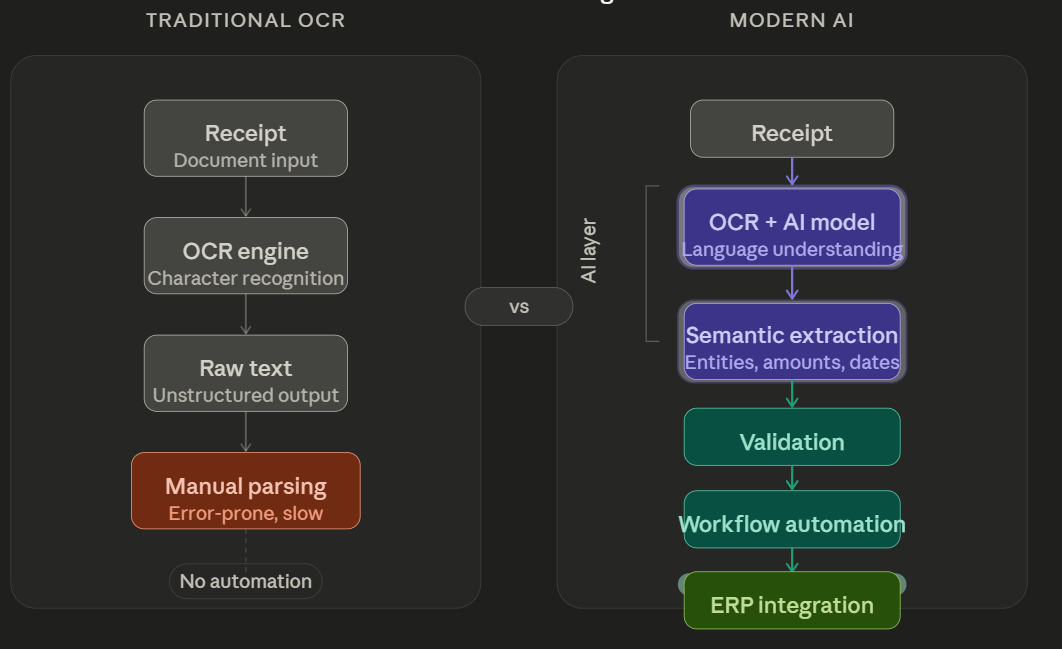
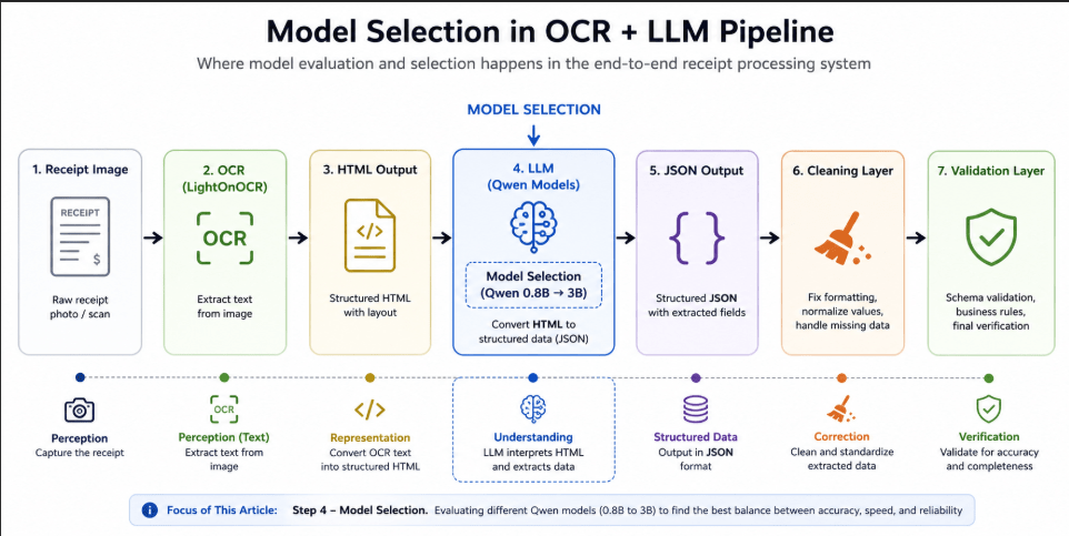
Receipt extraction initially appears to be a straightforward OCR problem. Scan the document.Extract the text.Convert it […]
One of the biggest misconceptions around AI document automation is the idea that language models alone […]
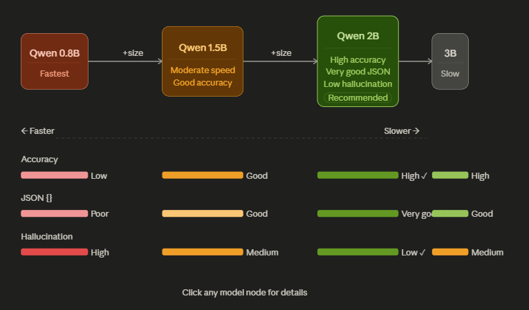
For a long time, small language models were mostly dismissed for real operational workflows. They were […]
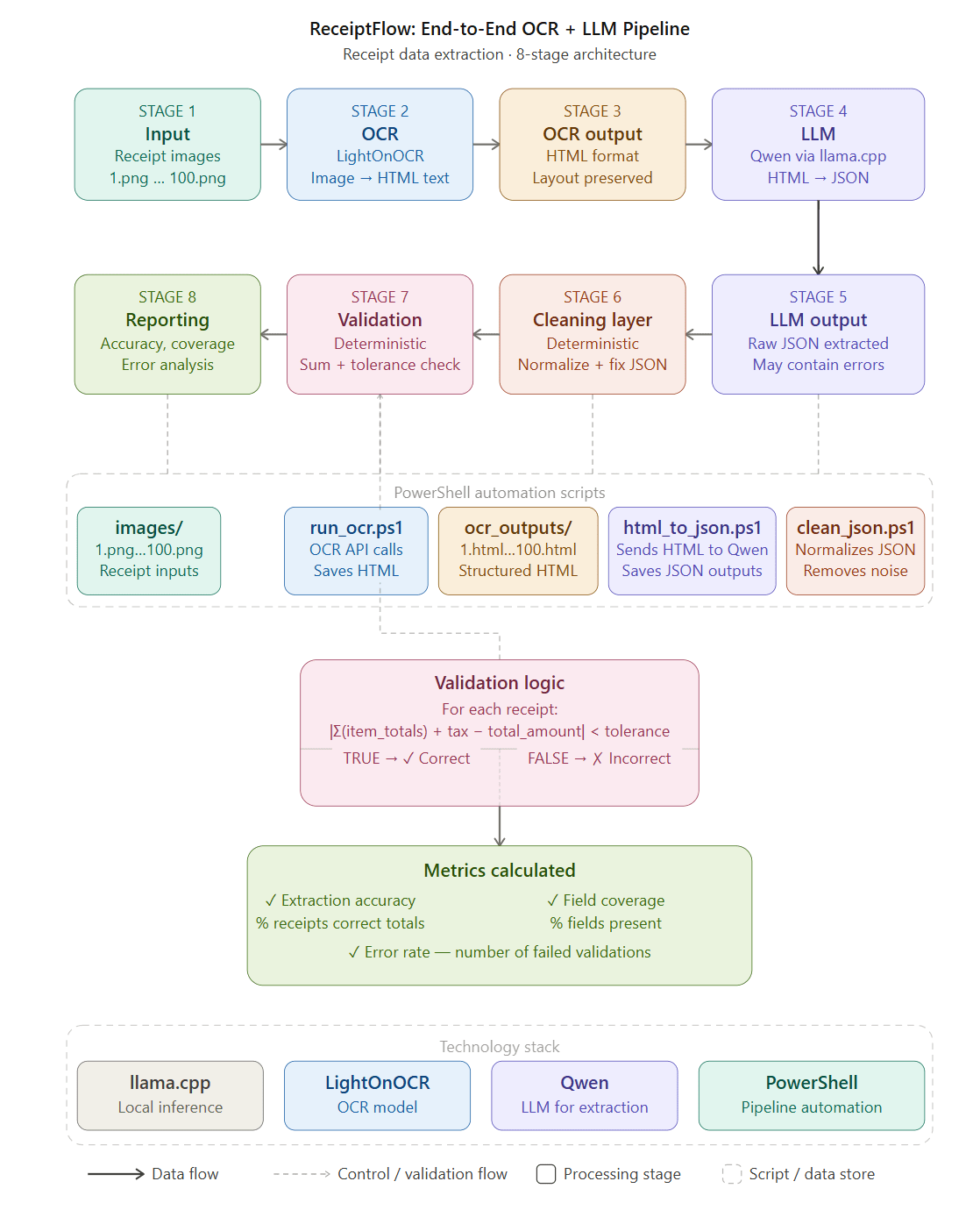
Most receipt digitization systems today rely heavily on cloud APIs. You upload a receipt, the document […]
Most discussions around OCR and document AI focus heavily on technology. Better extraction.Better models.Better automation. But […]
For most people, OCR still sounds like a very old technology problem. Scan a document.Extract the […]
Receipt and invoice digitization has evolved far beyond traditional OCR systems. Modern SaaS platforms now combine […]